 Available for Import
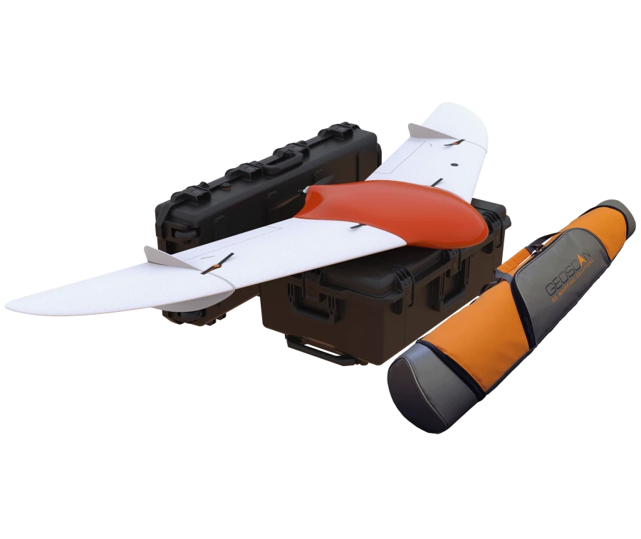
Geoscan 201 Drone Aviation System for Precision Aerial Surveying
Manufacturer:
GEOSCAN LLC
Price:
Request Quote
Bulk pricing available
FOB, CIF & EXW terms available
Description
Geoscan 201 is an unmanned aerial system that includes an unmanned aerial vehicle (UAV), a launcher and flight mission planning software. The system is designed to automatically perform flights of up to 3 hours duration.
Specifications
Type of product according to PP RF 616
Helicopters and airplanes
Max. flight duration
180
Max. route length
210
Max. permissible wind speed
B1/B8 2100/900 MHz
Max. airspeed
130
Max. takeoff weight
8.5 kg
Max. payload weight
1.5 kg
Wingspan
222 cm
Max. flight altitude
4000 m
Engine type
Electric, colectorless
Takeoff
From the launcher
Planting
By parachute, in automatic mode
Operating temperature
From -20 to +40 C
Note: All specifications are provided by the manufacturer and may be subject to change. Please contact us to confirm the latest specifications before placing your order.
Share your requirements for a quick response!
Instant response in 15 minutes
Best wholesale prices guaranteed
Direct from manufacturer
Delivery & Payment
Shipping Terms
Delivery Time
Sea freight: 30-60 days (depending on destination)
Air freight: 14-21 days (for urgent orders)
Payment Methods
Similar Products You May Be Interested In
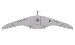
Remote Aerial Surveillance Drone System "Supercam S350F
View Details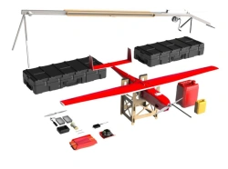
Geoscan 701 Unmanned Aerial System for Aerial Photography
View Details
LUN-20 Unmanned Aerial System (UAS) ACI 791488 025
View Details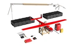
Aerial Photography Drone System Geoscan 701
View Details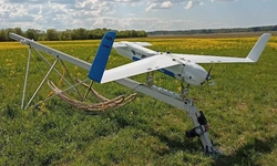
Drone Aviation System DIAM 20
View Details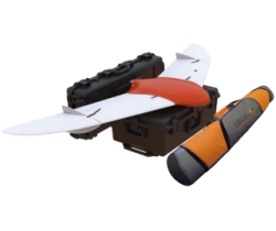
Geoscan 201T Unmanned Aerial System
View Details
ZALA T-20 Electric Drone for Aerial Surveillance
View Details
Professional UAV Aircraft Type with Internal Combustion Engine
View Details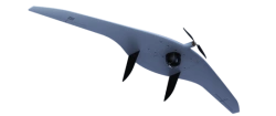
Supercam S350 Unmanned Aerial Complex for Remote Area Surveillance
View Details
Unmanned Aerial Vehicle for Radio Signal Relay
View Details
Ecological Monitoring Drone Ecolibri R-30
View Details
AIST UAV with Engine and eVTOL for Aerial Photography and Monitoring
View DetailsVerified Suppliers
All products are sourced directly from authorized Russian manufacturers
Quality Assurance
Products meet international quality standards with proper certification
Global Shipping
Reliable logistics solutions to deliver products to your location
Secure Payments
Multiple secure payment options to facilitate international transactions